Architecture and plugins
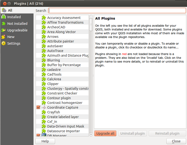
QGIS has a core programme, with the option to extend its functionality by installing plugins. Some of these are automatically installed with the programme, while others are available from the QGIS Plugins Repository. This contains hundreds of plugins, including some flagged as Experimental - bear in mind that these may or may not do what you want them to.
Some handy plugins include:
- OpenLayers: brings in background mapping from OpenStreetMap, Google, Bing and others
- InaSAFE: a tool for modelling the impact of natural hazards
- HeatMap: creates a heat map from point data
- TimeManager: creates animations from time series data
- GroupStats: a kind of mini pivot table creator
- Table Manager: a very simple tool to add, amend and delete fields
Plugins are managed from the QGIS Plugins menu - you can choose which ones to install, and which ones to activate.

The Settings option allows you to choose whether to show 'expermental' plugins in the list of available plugins, and also whether to check for updates to plugins when QGIS loads - it's recommended that you activate this, as many plugins are updated regularly (especially the experimental ones).
Exercise: Open up QGIS, configure the UI as described earlier, then choose a few plugins to install (including OpenLayers). Note that the information page for each plugin shown in the Plugins Manager should also tell you how to access it in QGIS - sometimes it's the
Pluginsmenu, and sometimes plugins create their own menu and/or toolbar.